‘Rivers List In India’ PDF Quick download link is given at the bottom of this article. You can see the PDF demo, size of the PDF, page numbers, and direct download Free PDF of ‘List Of Rivers’ using the download button.
List Of Rivers In India PDF Free Download
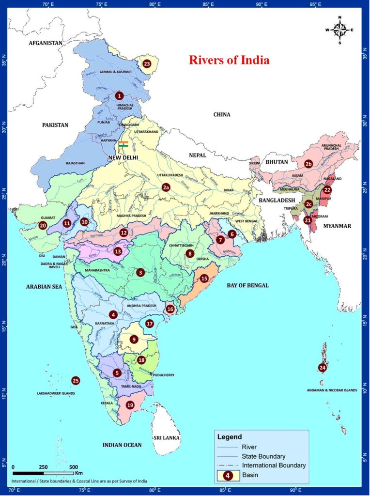
Complete List of Rivers With Lengths And Origins
The following list shows the names of rivers in India with their lengths, origins, and End of the River.
| S.No. | Rivers | Origin | Length (km) | End |
| 1. | Ganga | Gangotri Glacier (Bhagirathi), Uttarakhand | 2,525 | Bay of Bengal |
| 2. | Yamuna | Yamunotri Glacier, Uttarakhand | 1,376 | Merges with Ganga at Allahabad (Triveni Sangam – Kumbh Mela spot |
| 3. | Brahmaputra | Himalayan Glacier in Tibet, but enters India in Arunachal Pradesh | 1,800 | Merges with Ganga and ends in Bay of Bengal |
| 4. | Chambal | Tributary of Yamuna river, starting at Madhya Pradesh | 960 | Joins Yamuna river in UP |
| 5. | Son | Tributary of Ganga, starting at Amarkantak, Madhya Pradesh | 784 | Joins Ganga just above Patna – also considered part of Vindhya river system |
| 6. | Gandak | Nepal; Ganges tributary at Indo-Nepal border (Triveni Sangam) | 630 | Joins Ganga near Patna |
| 7. | Kosi | Starts from Bihar near Indo-Nepal border | 720 | Joins Ganga near Katihar district of Bihar |
| 8. | Betwa | Tributary of Yamuna, rises at Vindhya region, MP | 590 | Joins Yamuna at Hamirpur in UP |
| 9. | Gomti | Tributary of Ganga, starting at Gomat Taal, UP | 900 | Joins Ganga in Varanasi district |
| 10. | Ghaghara | Himalayan Glacier in Tibet, tributary of Ganga | 1080 | Joins Ganga in Bihar |
| 11. | Hugli (Hooghly) | Tributary of Ganga near West Bengal | 260 | Merges with Ganga at Bay of Bengal |
| 12. | Damodar | Tributary of Hugli near Chandwara, Jharkhand | 592 | Merges with Hugli in West Bengal |
| 13. | Mahananda | Paglajhora falls, Darjeeling, West Bengal | 360 | Merge in Ganga |
| 14. | Alaknanda | Satopanth & Bhagirathi-Kharak glacier | 190 | Merge in Ganga, Devprayag, Uttarakhand |
| 15. | Bhagirathi | Gaumukh, Uttarakhand | 205 | Merge in Ganga, Devprayag, Uttarakhand |
| 16. | Indus | Originates in Tibetan plateau, Enters India in J&K | 3180 | Merges into Arabian sea near Sindh |
| 17. | Chenab | Upper Himalayas in the Spiti district of Himachal Pradesh | 960 | Merges with Indus |
| 18. | Jhelum | Tributary of Chenab river, Punjab | 725 | Merges with Chenab at Jhang (Pakistan) |
| 19. | Ravi | Starts from Bara Bhangal, Kangra district, Himachal Pradesh | 720 | Joins Chenab in Pakistan |
| 20. | Sutlej | Tributary of Indus river, originates at Rakshastal, Tibet | 1500 | Meets Beas river in Pakistan and ends at Arabian sea |
| 21. | Beas | Rises at Himalayas in central Himachal Pradesh | 470 | Joins Sutlej river in Punjab, India |
| 22. | Parbati | Mantalai Glacier near Pin Prabati Pass | – | Mixes with Beas River at Bhuntar, near Kullu of Himachal Pradesh |
| 23. | Suru | Panzella Glacier, Pensi La Pass, Kargil | 185 | Indus, Nurla, Skardu, Pakistan |
| 24. | Dras | Machoi Glacier, Zoji La, ear Sonamarg, Jammu & Kashmir | 86 | Suru River at Kharul, Kargil |
| 25. | Zanskar | Doda River (First Branch), Kargyag and Tsarap River (Second Branch) | – | Indus River near Nimmu in Ladakh |
| 26. | Tsarap | Pankpo La, Sarchu | 182 | Zanskar River, Padum, Kargil |
| 27. | Doda | Drang-Drung Glacier, Pensi La | 79 | Zanskar River, Padum, Kargil |
| 28. | Kaveri | Talakaveri in Western Ghats in Karnataka | 765 | Ends in Bay of Bengal |
| 29. | Krishna | Originates in the Western Ghats near Mahabaleshwar in Maharashtra | 1400 | Ends in Bay of Bengal near Andhra Pradesh |
| 30. | Godavari | Starts in Maharashtra and passes through 7 Indian states | 1465 | Empties in Bay of Bengal |
| 31. | Tungabhadra | Tributary of Krishna river staring at Karnataka | 531 | Joins Krishna river along the border of Telangana and Andhra Pradesh |
| 32. | Tapti | Rises in Eastern Satpura Ranges, Madhya Pradesh | 724 | Empties into Gulf of Khambhat, Gujarat |
| 33. | Mahi | Rises in Madhya Pradesh | 580 | Flows into Arabian sea from Gujarat |
| 34. | Narmada | Starts from Amarkantak, Madhya Pradesh | 1315 | Drains into Arabian sea via Gulf of Cambay |
| 35. | Indravati | Dandakaranya range, Kalahandi district, Odisha | 535 | Godavari near border of Maharashtra, Chhattisgarh and Telangana |
| 36. | Pranhita | Confluence of Wardha and Wainganga, near Sirpur Kaghaznagar | 113 | Godavari, near Kaleshwaram, Telangana |
| 37. | Wardha | Satpura range, Multai, Betul district of Madhya Pradesh | 528 | Pranhita River |
| 38. | Kolab (Sabari) | Sinkaran hills, Koraput, Odisha | 200 | Godavari |
| 39. | Manjira | Balaghat hills | 724 | Godavari, near Kandakurthi, Karnataka |
| 40. | Wainganga | Satpura range, Mundara, Seoni district, Madhya Pradesh | 579 | Pranhita River |
| 41. | Painganga | Ajanta range, Aurangabad, Maharashtra | 676 | Wardha river, Chandrapur district, Maharashtra |
| 42. | Vedavathi | Confluence of Veda and Avathi | – | Tungabhadra river, near Siruguppa |
| 43. | Bhima | Bhimashankar | 861 | Krishna river, near raichur |
| 44. | Indrayani | Lonavala, Maharashtra | Bhima river | |
| 45. | Pavana | Sahyadri range, Lonavala Maharashtra | 58 | Mula river |
| 46. | Ghataprabha | Western ghats, Sindhudurg, Maharashtra | 283 | Krishna river, Almatti |
| 47. | Venna | Mahabaleshwar, Maharashtra | 130 | Krishna river, Satara, Maharashtra |
| 48. | Koyna | Mahabaleshwar, Maharashtra | 130 | Krishna river, near Karad, Satara |
| 49. | Amravati | Anamalai hills, Pambar, Chinnar rivers | 282 | Kaveri river at Karur, Tamil Nadu |
| 50. | Bhavani | Silent Valley National Park, Kerala | 135 | Kaveri river at Kongu Nadu region of Tamil Nadu |
| 51. | Hemavati | Western Ghats, Chikmagalur, Karnataka | 245 | Kaveri river near Krishna Raja Sagara, Karnataka |
| 52. | Mahanadi | Dhamtari, Dandakaranya, Chhattisgarh | 858 | Bay of Bengal, near False Point, Kendrapara, Odisha |
| 53. | Subarnarekha | Chota Nagpur plateau, near Ranchi, Jharkhand | 395 | Kirtania Port, near Talsari, Bay of Bengal |
| 54. | Kangsabati | Chota Nagpur plateau, Purulia district, West Bengal | 465 | Bay of Bengal near Haldia |
| 55. | Penner (Penna) | Nandi Hills, Chikkaballapur district, Karnataka | 597 | Bay of Bengal, near Nellore, Andhra Pradesh |
| 56. | Palar | Nandi hills, Kolar district Karnataka | 348 | Bay of Bengal, near Vayalur, Tamil Nadu |
| 57. | Vaigai | Varusanadu Hills, Tamil Nadu | 258 | Palk Strait, Tamil Nadu |
| 58. | Vellar | Shevaroy Hills | 150 | The Bay of Bengal, near Parangipettai, Tamil Nadu |
| 59. | Ponnaiyar | Nandidurg, Chikkaballapur | 400 | Bay of Bengal |
| 60. | Noyyal | Velliangiri Hills, Western Ghats, Tamil Nadu | 180 | Kaveri river |
| 61. | Gomai | Satpura Range | – | Tapti river, near Prakasha, Nandurbar, Maharashtra |
| 62. | Panzara | Near Pimpalaner, Dhule, Maharashtra | – | Tapti river |
| 63. | Purna | Satpura Range, Betul, Madhya Pradesh | – | Tapti river, near Changdev, Maharashtra |
| 64. | Kolar | Vindhya Range, near Sehore district, Madhya Pradesh | 101 | Narmada, near Raisen district of Madhya Pradesh |
| 65. | Tawa | Satpura Range, Betul, Madhya Pradesh | 172 | Narmada near Hoshangabad district |
| 66. | Sabarmati | Dhebar lake, Aravalli range, near Udaipur, Rajasthan | 371 | Gulf of Khambhat |
| 67. | Zuari | Hemad-Barshem in western ghats | 34 | Arabian sea |
| 68. | Ulhas | Near Rajmachi hills, Sahyadri range | 122 | Vasai Creek, Mumbai |
| 69. | Mithi | Vihar lake and Powai lake | 15 | Arabian sea, Mahim creek, Mumbai |
| 70. | Mandovi | Bhimgad, Karnataka | 77 | Arabian sea |
| 71. | Kali | Kushavali, Karnataka | 184 | Arabian sea |
| 72. | Netravati | Kudremukh, Chikmagalur, Karnataka | – | Arabian sea, near Mangalore, Karnataka |
| 73. | Sharavati | Western Ghats, Tirthahalli, Karnataka | 128 | Arabian sea, near Honnavar, Uttar Kannada district, Karnataka |
| 74. | Periyar | Sivagiri hills, Sundaramala, Tamil Nadu | 244 | Lakshadweep sea, Kerala |
| 75. | Bharathappuzha | Anamalai Hills, Tamil Nadu | 209 | Lakshadweep sea, Ponnani, Kerala |
| 76. | Pamba | Pulachimalai Hills, Western Ghats | 176 | Vembanad Lake |
| 77. | Chaliyar | Elambaleri Hills, Western Ghats, Wayanad, Kerala | 169 | Lakshadweep sea, Kerala |
Top 10 Longest Rivers In India With All Detalis
1. The Ganges River- 2525 km
The Ganges, known as Ganga in India is the most sacred river when it comes to Hindu beliefs and it is also the longest river, enclosed with the Indian subcontinent. Its origin is the Gangotri Glacier in Uttarakhand and it starts at the confluence of Bhagirathi and Alaknanda rivers in Devprayag, Uttarakhand.
The Ganges is compromised by contamination, not exclusively to people, yet in addition to creatures, among which are in excess of 140 fish species, 90 land and water proficient species, reptiles, for example, the gharial, and warm-blooded creatures, for example, the Ganges waterway dolphin, the last-referenced two incorporated into the IUCN’s basically imperiled list.
The Ganges is the longest river in India and also the largest river in India followed by Godavari (1465 kms).
The states that are covered by this waterbody are Uttarakhand, Uttar Pradesh, Bihar, and West Bengal. The last part of the Ganges ends in Bangladesh, where it finally converges in the Bay of Bengal. Some of the primary tributaries of the Ganga are the Yamuna, Son, Gomti, Ghaghara, Gandak, and Koshi.
2. Godavari River- 1464 km
Again, in terms of the total length covered within India, the Godavari aka Dakshin Ganga or South Ganges is the second longest river in India.
It begins from Triambakeshwar, Nasik in Maharashtra, and traverses via Chhattisgarh, Telangana and Andhra Pradesh, after which it finally meets with the Bay of Bengal.
The major tributaries of the river can be classified as the left bank tributaries which include the Purna, Pranhita, Indravati and Sabari River.
The stream is sacred to Hindus and has a few places on its banks, that have been spots of the journey for a large number of years.
Its total span in terms of length is 1,450 kilometers. Some of the prime cities on the banks of Godavari are Nashik, Nanded, and Rajahmundry.
3. Krishna River- 1400 km
Krishna, is the third-longest river in India in terms of length in India and the fourth-longest river in India (within the country’s borders) in terms of water inflows and river basin area, following the Ganges, Godavari, and the Brahmaputra. It serves as one of the prominent sources of irrigation for the states of Maharashtra, Karnataka, Telangana, and Andhra Pradesh.
It originates in Mahabaleshwar and then enters the Bay of Bengal after flowing through these states.
The main tributaries of the Krishna are Bhima, Panchganga, Dudhaganga, Ghataprabha, Tungabhadra and its main cities by the banks are Sangli and Vijayawada.
4. Yamuna River- 1376 km
The Yamuna also called Jamuna, originated from the Yamunotri glacier at the Banderpoonch peak in the Uttarkashi district of Uttarakhand.
It is the longest tributary of the River Ganges and it does not directly fall into the sea.
Hindon, Sharda, Giri, Rishiganga, Hanuman Ganga, Sasur, Chambal, Betwa, Ken, Sindh, and Tons are the tributary rivers of Yamuna.
The major states through which the river flows are Uttarakhand, Himachal Pradesh, Delhi, Haryana and Uttar Pradesh.
5. Narmada River- 1312 km
The Narmada River also called the Rewa and previously also known as Nerbudda, originates from the Amarkantak.
It is also known as the “Life Line of Madhya Pradesh and Gujarat” for its huge contribution to the state of Madhya Pradesh and Gujarat.
In contrast with all the rivers of the country that flow in the east direction, it flows westward. It is also considered one of the holiest water bodies.
To Hindus the Narmada is one of the seven heavenly waterways of India; the other six being Ganges, Yamuna, Godavari, Saraswati, Sindhu, and Kaveri.
The Ramayana, the Mahabharat, and the Puranas allude to it oftentimes.
6. Indus River- 3180 km
The history of the name of our country is related to the Indus, it begins from Mansarovar Lake and then crosses Ladakh, Gilgit, and Baltistan.
It then enters Pakistan.
The Indus is also known for harboring one of the oldest and flourishing civilizations, the Indus Valley Civilization.
Its main tributaries include Jansker, Soan, Jhelum, Chenab, Ravi, Sutlej, and Beas. Major Cities located on the banks of Indus are Leh and Skardu.
The total length of the Indus River is 3180 kilometers. However, its distance covered within India is only 1,114 kilometers.
7. Brahmaputra River- 2900 km
The Brahmaputra is the second river that originates from the Mansarovar ranges. It originates from Angsi Glacier near Mansarovar Lake, Tibet, China. It is the sole river whose gender is considered male in India.
It is called the Yarlung Tsangpo River in China, and then it enters India via Arunachal Pradesh. During the rainstorm season (June–October), floods are an exceptionally normal event.
The Kaziranga National Park is on the banks of Brahmaputra. It then traverses through Assam and finally enters Bangladesh. Its total length within India is only 916 kilometers.
The Majuli or Majoli is a river island in the Brahmaputra River, Assam and in 2016 it became the first island to be made a district in India. It had an area of 880 square kilometers at the beginning of the 20th century.
8. Mahanadi River- 890 km
The Mahanadi River originates in the Raipur district of Chhattisgarh. The Mahanadi was infamous for its staggering floods for a lot of written history.
Hence it was called ‘the distress of Odisha’. Anyway, the development of the Hirakud Dam has enormously modified the circumstance.
Today a system of waterways, blasts, and check dams keep the stream well in charge. Its major tributaries are Seonath, Mand, Ib, Hasdeo, Ong, parry river, Jonk, Telen.
9. Kaveri River- 800 km
Kaveri River, also spelled Cauvery, sacred river of southern India. It rises in Brahmagiri Hill of the Western Ghats in Karnataka, flows in a southeasterly direction through the states of Karnataka and Tamil Nadu, and descends the Eastern Ghats.
Before emptying into the Bay of Bengal, Tamil Nadu, the river breaks into a large number of distributaries forming a wide delta called the “garden of southern India.”
The Kaveri River is celebrated for its scenery and sanctity in Tamil literature, and its entire course is considered holy ground. The river is also important for its irrigation canal projects.
10. Tapti River- 724 km
Tapti River is one of the only three rivers that originate in Peninsular India and that runs from east to west. It rises in the Betul district (Satpura Range) and drains off into the Gulf of Khambhat (Arabian Sea).
It runs through Madhya Pradesh, Maharashtra and Gujarat and has six tributaries. The tributaries rivers of Tapti river are Purna River, Girna River, Gomai, Panzara, Pedhi and Arna.
| Author | – |
| Language | English |
| No. of Pages | 4 |
| PDF Size | 1 MB |
| Category | Education |
It is not specified officially in the India River Map till now which one is the smallest river in India.
The Ganga is declared as the national river of India.
Ganga Basin is the largest river basin in India with an area of about 861452 sq. km.
The Brahmaputra is the widest river in India.
Related PDFs
S.Y.B.A. Marathi Question PDF For University Student
List of Rivers In India PDF Free Download