‘Printable Bihar Map’ PDF Quick download link is given at the bottom of this article. You can see the PDF demo, size of the PDF, page numbers, and direct download Free PDF of ‘बिहार का मानचित्र’ using the download button.
बिहार का नक्शा – Bihar Map With District Book PDF Free Download
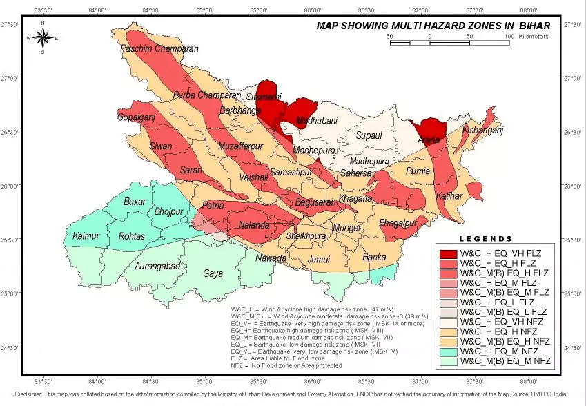
Bihar Map For BPSC Students
बिहार के बारे में
बिहार का प्राचीन नाम ’विहार’ था, जिसका मतलब मठ होता है। यह भारत के पूर्वी भाग में स्थित है। क्षेत्रफल के हिसाब से बिहार भारत का बारहवां सबसे बड़ा और आबादी के मान से तीसरा सबसे अधिक जनसंख्या वाला राज्य है।
बंगाल के तिकोने क्षेत्र में पहुंचने से पहले गंगा नदी इस राज्य से बहती है जिसके कारण यह राज्य वनस्पति और जीव-जन्तुओं से समृद्ध है। बिहार का वन क्षेत्र भी विशाल है जो कि 6,764 वर्ग किमी है।
यह राज्य भाषाई तौर पर प्रभावकारी है क्योंकि यहां कई भाषाएं बोली जाती हैं, जैसे भोजपुरी, मैथिली, मगही, बज्जिका और अंगिका।
बिहार की राजधानी पटना है, जिसका नाम पहले पाटलीपुत्र था। भारत के कुछ महान राजाओं जैसे समुद्रगुप्त, चन्द्रगुप्त मौर्य, विेक्रमादित्य और अशोक के शासन में बिहार शक्ति, संस्कृति और शिक्षा का केन्द्र बन गया।
यहां उस समय के दो महान शिक्षा केन्द्र भी थे, विक्रमशिला और नालंदा विश्वविद्यालय। बिहार में आज भी यहां के 3,000 साल पुराने इतिहास की गवाही देते कई प्राचीन स्मारक मौजूद हैं और विश्वभर के लाखों पर्यटक इन्हें देखने आते हैं। राज्य में स्थित महाबोधि मंदिर को यूनेस्को द्वारा विरासत स्थल घोषित किया गया है।
बिहार का इतिहास
प्राचीन बिहार जिसका नाम मगध था ने, 1,000 सालों तक सत्ता, शिक्षा और संस्कृति के क्षेत्र में निर्णायक भूमिका निभाई।
मौर्य नाम का पहला भारतीय साम्राज्य 352 ईस्वी में मगध में ही शुरु हुआ और उसकी राजधानी पाटलीपुत्र यानी आज का पटना थी। 240 ईस्वी में मगध में गुप्त साम्राज्य आया। गुप्त के नेतृत्व में भारत ने विश्व अर्थव्यवस्था पर प्रभुत्व हासिल किया।
बिहार के सासाराम के महान पश्तून शासक शेर शाह सूरी ने सन् 1540 में उत्तर भारत की बागडोर संभाली। वह मुगलकाल के सबसे प्रगतिशील शासकों में से एक थे और उनके शासन में बिहार खूब फलाफूला। मुगलों के पतन के बाद बिहार बंगाल के नवाबों के नियंत्रण में आ गया।
बिहार का भूगोल
बिहार की स्थिति ठीक 24ह्-20´ और 27ह्-31’ उत्तरी अक्षांश के बीच और 82ह्-19’ और 88ह्-17’ पूर्व देशांतर है। इस हिसाब से बिहार भारत के उत्तर पूर्वी भाग में स्थित है।
बिहार चारों ओर से जमीन से घिरा राज्य है, यह पूर्व में पश्चिम बंगाल, पश्चिम में उत्तर प्रदेश, उत्तर में नेपाल और दक्षिण में झारखंड राज्य से घिरा है।
बिहार की मिट्टी स्वाभाविक तौर पर उपजाउ है और इसकी यह विशेषताएं भारतीय-गंगा समतल क्षेत्र की गंगा जलोड़ मिट्टी के कारण हैं, पश्चिम चंपारण में दलदली मिट्टी और उत्तरी बिहार में तैराई मिट्टी मिलती है।
गंगा और उसकी सहायक नदियां बिहार में पश्चिम से पूर्व की ओर बहती हैं। बिहार के उत्तर में हिमालय पर्वत है जो वास्तव में नेपाल से शुरु होता है और इसके दक्षिण में कैमूर पठार और छोटानागपुर पठार है।
Geography Of Bihar
Bihar is located in the eastern part of the country (between 83°-30′ to 88°-00′ longitude). It is an entirely landlocked state, although the outlet to the sea through the port of Kolkata is not too far away.
Bihar lies mid-way between the humid West Bengal in the east and the sub-humid Uttar Pradesh in the west which provides it with a transitional position in respect of climate, economy, and culture. It is bounded by Nepal in the north and by Jharkhand in the south.
The Bihar plain is divided into two unequal halves by the river Ganga which flows through the middle from west to east.
History of Bihar
Bihar is a unique state endowed with a rich history. It is the seat of significant mythological events and tales from Ramayana. It is the birthplace of prominent religions including Buddhism and Jainism.
It was Bihar that sprouted the first seed of democracy. It was Bihar was first true kingdom, Maurya Empire, which reigned all over the subcontinent.
Patna, situated on the bank of the river Ganga, is the capital of Bihar, and the state’s current geographical boundary is shaped after its partition from Bengal and later on after separation of Jharkhand in 2000.
Art and Crafts
The state of Bihar is rich in its arts and crafts, which is quite evident from the fact that it is home to some of India’s first paintings, including the famous Madhubani paintings and the miniature paintings done on paper and leaves, wall decorations, patchwork, applique work and local handicrafts.
Mithila, a region situated to the north of Bihar, is the place where the Madhubani paintings are believed to have originated.
These paintings are Bihar’s most unique folk art, done on either paper or canvas by the women of Mithila.
The Miniature paintings make use of leaves or paper and depict the lives of Buddha or Mahavira. They are sold to pilgrims and tourists in Bodh Gaya and are quite popular.
Bihar is also famous for stone pottery, white metal statuettes, bamboo artifacts, wooden toys, and leather goods. The wood inlay is another ancient craft quite famous here.
In this craft, the craftsmen use different wood and metal to create inlaid designs for table toys, wall plaques, and trays. In north Bihar, a special grass called Sikki is found which when dyed in bright colors and woven with the natural grass makes excellent attractive baskets, boxes and figures.
Language and Literature
Hindi is the official language of the state. Maithili (including its dialect Bajjika), Bhojpuri, Angika and Magahi are also widely spoken in the state.
Maithili is a recognized regional language of India under the Eighth Schedule to the Constitution of India. Bhojpuri and Magahi are sociolinguistically a part of the Hindi Belt languages fold.
The golden period of Hindi Literature in Bihar
Hindi literature has flourished significantly in the state. Raja Radhika Raman Singh, Shiva Pujan Sahay, Divakar Prasad Vidyarthy, Ramdhari Singh Dinkar, Ram Briksha Benipuri, are some of the luminaries who contributed to the richness of Hindi literature.
The Hindi language and literature began around mid to late nineteenth century. It is marked by the appearance of Bhartendu Babu Harischandra’s (a resident of Varanasi in U.P.) drama “Harischandra”.
Devaki Nandan Khatri began writing his mystery novels in Hindi during this time (Chandrakanta, Chandrakanta Santati, Kajarki Kothari, Bhootnath, etc.) He was born at Muzaffarpur and spent a part of his life in Tekari Estate in Gaya in Bihar.
He later became an employee of the Raja of Benares (now Varanasi.) He started a printing press called “Lahari” which began the publication of a Hindi monthly, “Sudarshan”, in 1898.
One of the first short stories in Hindi was “Indumati” written by Pundit Kishorilal Goswami and published in 1900.
The collection of short stories “Rajani our Taare” published by Anupam Prakashan in Patna contains an extended history of the origin and evolution of the short story as a distinct literary form in the Hindi literature.
| बिहार पर तथ्य | |
|---|---|
| आधिकारिक वेबसाइट | www.gov.bih.nic.in |
| स्थापना का दिन | 1912 बिहार के रूप में, (उड़ीसा प्रांत – बिहार), 26 जनवरी 1950 |
| क्षेत्रफल | 94,163 वर्ग किमी |
| घनत्व | 1,102 प्रति वर्ग किमी |
| जनसंख्या (2011) | 104,099,452 |
| पुरुषों की जनसंख्या (2011) | 54,278,157 |
| महिलाओं की जनसंख्या (2011) | 49,821,295 |
| जिले | 38 |
| राजधानी | पटना |
| नदियाँ | कोसी, गंगा, सरयू, गंडक, कमला, पनर, सौरा, पुनपुन |
| वन एवं राष्ट्रीय उद्यान | वाल्मीकि राष्ट्रीय उद्यान, राजगीर अभयारण्य, भीमबांध अभयारण्य, गौतम बुद्ध अभयारण्य, उदयपुर अभयारण्य |
| भाषाएँ | हिंदी, भोजपुरी, मैथिली, अंगिका, मगही |
| पड़ोसी राज्य | झारखंड, उत्तर प्रदेश, पश्चिम बंगाल |
| राजकीय पशु | बैल |
| राजकीय पक्षी | गौरैया |
| राजकीय वृक्ष | पीपल |
| राजकीय फूल | गेंदा |
| नेट राज्य घरेलू उत्पाद (2011) | 20708 |
| साक्षरता दर (2011) | 63.82% |
| 1000 पुरुषों पर महिलायें | 916 |
| विधानसभा निर्वाचन क्षेत्र | 243 |
| संसदीय निर्वाचन क्षेत्र | 40 |
| Author | Government of Bihar |
| Language | English |
| No. of Pages | 8 |
| PDF Size | 0.9 MB |
| Category | Geography |
| Source/Credits | bihar.gov.in |
- Download Printable Outline Map Of Bihar State, Click Here
- Bihar Colored Map PDF Download, Click Here
Related PDFs
बिहार का मानचित्र – Bihar Map with District and River for BPSC Student PDF Free Download